Monday, April 27, 2009

Tela to Utila, Bay Islands


about 56 miles. 2.5 hours because of rain.
The road from Tela to La Ceiba was pretty straight forward, busy with local traffic. it finally rained on us so we ducked into a bus stop for about 20 minutes. it seemed to be letting up so we continued only to do the same thing 15 minutes later. We decided to just put on our rain pants and go. Eventuallyti stopped and we took off the rain gear tolet our Carharts dry out. the signs to La Ceiba are good. because the muelle/peir for the Utila ferry is out of town, we decied to go see what was going on there and if we could stay in a hotel close to the pier to save a taxi ride fromt he center the next morning. We decided to just leave the bike at the port for $6/day, uncoved but with a security entrance, and not pay for a hotel or stay in La Ceiba since we had no real desire to be there. We happen to arrive at 3 and the ferry left at 4. so we quickly did the paperwork to leave it, took of a box and the tank bag and filled them with need things, and left one box attached with uneeded things. we had to take our jackets and helmet and things instead of leaving them in a hotel but at least we got there a day earlier. We are hanging out on Utila for the week now. It's a backpacker seen for sure. Steve is doing his diving cert and I am getting some down time until we dive today. yipee.

Sunday, April 26, 2009

Tela and Garifuna Villages


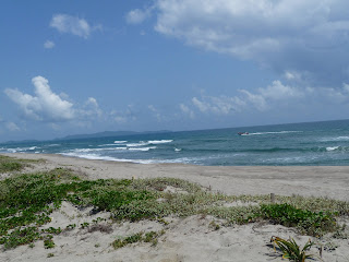
When we got to Tela we decided to find a nice place to stay. After no sleep at the Backpakers in Rio Dulce and a long day, we needed some sleep. Tela was pretty relaxed and we were happy to see that there were so many bicycles. We went out to Miami, San Juan and Tornabe villages the next day as a day trip. These are Black Carib villages. The road is basically the beach. A sand strip in the bushes of the beach. It stops at the beginning of Miami village.

It was tough to get used to, not having much sand expereince from Colorado. It took about 45 minutes to get through to where the road turns to sand after Tornabe and another 45 of the sand. lots of sun. The villages are really interesting. Palapa homes on the beach. a couple horses, few trucks to none. We hung out on some restaurant hammocks all day. Steve got a plate of fish for $5 and we just enjoyed the breeze in the shade and the warm water on the private beach.
The next day we went to the Biological Park \Lancetilla. We stayed about 2 hours, it was pretty nice. Relaxing.

Rio Dulce Guatemal to Tela Honduras, Through Coronito


191 miles. 40 miles of dirt. From Rio Dulce headed east to the border. The roads are paved and in great condition. We did, however, ride through a small swarm of bees. Enough to keep you creepy crawly for a few hours. They hit very hard on my knee and face. About ten minutes later, I noticed two still stuck to Steve's jacket and glove so pulled over to do the shake down. Another ten minutes later I got a mild sting on my arm, inside my jacket! I couldnt get Steve to pull over fast enough and get it off. Over an hour later, we found one still alive clinging to the edge of the gas cap. Crazy.

The turn off to the border is a dashed line on our map, but it is paved the hole way and in good shape, lined with banana plantations. There is a good little comedor for breakfast in Entre Rios, the turn off town. Its Yellow and was hiding behind a large pile of pineapples when we passed it.
We drove through the borders as the CA4 allows you to do and took the first dirt road on the right. The only people that wanted us to stop were money changers. This dashed line route goes from Coronito to Quimistan and meets up with a small road there allowing you to bypass San Pedro. We asked a man in front of a shop about the road conditions and immediately I remembered how nice Hondurans are. Good directions, detailed. Cross the little bridge ahead, ... He said it is passable but the main bridge went out. So there is a bypass and we should be able to make it. He gave us lots of info. In Guatemala and Mexico, as directions, people just sort of give a vague whip of the arm that I could never quite interpret correctly.
So we continued through the town and into the woods, up the mountains, and missed the turn he told us to take. I didn't even see it. Crossed a river. Saw a man on a bike huffing up a hill. So, at the top I asked him and he told us to continue ahead and take a left. We continued. And we missed it.
We sat at the big river for a few minutes contemplating the possiblities that I was not up for. Back out to the road and the bicycle man was right there, telling us we missed it. Again he offered to show us the road. No, no, but thank you. so nice.
So we turn around and realized the scale of the roads we are missing. They look like seldom used drive ways. So we took it this time and it went up, and got very rutted, and went steeper and got worse. At this point Steve couldn't stop so he just made it happen and we got to a flatish apot and said Holy Shit.
This was a dirt bike trail, a horse track, not a road.
So I decided to walk up the hill a while to see what was in store. After discussing the possiblities, I walked and Steve went for it. And went for it. And then the bike had enough of the steepness, stalled out, slid back a few feet and slowly leaned over onto a big rock. So the aluminium boxes are very strong if you were wondering.
More discussion, more refusial on my part to turn around and encouragement to go on. It seemed almost more dangerous try and turn around and go down that beginning bit. So the boxes and tank bag came off to lighten the load. Steve road the bike up to the top, and we carried it all up. We brought straps for the boxes and they came in big-time handy.

When we got to the top, dripping with sweat and starting to put the boxes back on, a family came by walking their enormous pig on a leash - staring at us strangely. But the man still smiled.
So the view was great, and off we went hoping it would get better and not worse. We came across an intersection of a small rocky road and figured it was the inital left that we had missed meeting up and I asked a group of boys about that and the road. More interesting is that these three boys ages 4-10 all had machetes on their waists or in their hands. I cant imagine the outcome of giving machetes to a group of young American boys ....

The road evened out and became a pleaseure. great views. small villages. small scale agriculture. and about 100 river crossing, most very small. The road still went up very steeply but was manageable. We asked quite a few people if we were still headed for Quimistam and eventually we made it - with no Limpera for a watermelon juice. what tourture. no ATM. Hadn't stopped to change money at the border.
The bridge should be back in order in the future. I would definately go this way. People were super welcoming, Waving even before we waved to them.
From Quimistan it was a straight shot to El Progresso and up to Tela. The whole day took 9.5 hours. We drove past all the trucks waiting in line at the border.

Saturday, April 25, 2009

Semuc Champey to Rio Dulce via Cahabon


Semuc to Rio Dulce 114 miles. 8 hours with an hour for lunch. We left in the direction of Lenquin towards Cahabon. Steve thought it would be the worlds best motorcycle road, if it were one way traffic. We had to go pretty slow to be careful of oncoming traffic. The road was very curvey, nice views and vegetation for a couple hours. Interesting houses and bridges. It was a pretty smooth, good condition dirt road. Compared to what we went over to get there, anything would be good. Got out to Lenquin in 20 min, and about an hour to Cahabon. There are hotels there. Seems like a nice enough place to stay but we only stuck around long enough for two slices of watermelon, a couple mangoes for the road. People were more open to us being in this area than the previous day.

Got to Panzos intersection in 4 hours. From there we turn East to El Estor. To go the other direction on that road is not a good option as two colectivos that passed us both had police escorts for the westerly direction past Panzos. We hoped the road past Lake Isabel would be a nice drive but it was dusty and boring with no great views of the lake. There was a lot of construction so the road should be in better condition soon, for us it was slow. The chain was caked in dust and oil from the trip. Gas was 22 quetzal a gallon.

Rio Dulce is busy and should have some supplies. People looked at the bike with a different attention here than anywhere else so far. They sort of knew what they were looking at and we prefer that they don't. The timing works well to stop here but I can't see much more reason to stay unless you are looking for luxery. Many of the hotels are expensive, catering to the boating crowd. So we stayed at the Backpapers Hotel which is right on the river, which felt amazing. But it was the loudest night of the trip, located beneath a large bridge that trucks accelerate up and brake down with those increadably loud brakes, all night. for $20US.

Thursday, April 23, 2009

El Naranjo to Semuc Champey - wow long day


Semuc Champay swimming holes


Semuc Champey El Ceibal Ruins

12 hour day, 228 miles. El Cebal Ruins visit, but thats still slow.
we spent the first few hours on good road with little traffic. The burned jungle still is around us but at least it allows you to see the contour of the land. The hills are very steep and solitary.
The jungle appeared again before El Cebal. We drove in the 8k, 15 min rough and narrow road to the ruins. It is small but the setting is great. Huge trees and long trails separate ruins so you get to do a lot of walking in the shade of the jungle. It was nice. and again there was no one there. To top it off it's FREE.

Continuing on the road was fine to Sebol where 17k prior it turns to bumpy dirt. Then it gets crazy to Lenquin. A good bit of the road is under construction but our map does no justice to scale of this road. It is the road that never ends. First we got stopped with some passenger trucks to wait. They said one hour, 2 hours, and another person said not ill 8pm, which was 4 hours and dark. Not an option. The nice construciton guys - who have no radios, let us pass along the dirt edge, well i walked. Then we we shoed up on the unexpecting other group they let us pass the grader through the soft sand. It just kept getting worse once the workers were gone. Up, up, up, we went. It was very beautiful through the mountains and jungle edge through the valleys. The first man that let us through said it was 30 min to Lenquin (if you fly). Ok, so we figured and hours or so. Three hours later we arrived at Semuc Champey on a crazy difficult road.
And the People. First the villagers helped us hesitantly with our request for reasurance that we were in fact headed for Lenquin. Then they got shier, so Steve ask because maybe a woman shouldn't speak when there is a man with her. But then Steve couldn't ask the woman because they should talk to him. People were avoiding our eyes. No one would answer us, so on we went. we finally got a "yes, to the left" at the one crucial intersection. and slowly, for 20 more minutes we went up up up and down down down to one of the best little places in Guatemala. just as dark fell.

We stayed at las Marias, which is really basic, with no fans or screens set in a beautiful jungle valley. We woke up to the reminder not to leave food in your bag on the floor. Biting ant infestation took over the morning. Every item we own was shaken, blown, banged and hung. Peanuts were thrown away. Yuck.
Semuc is in a valley with a big deep river. And a big long rope swing! Semuc Champey is a waterfall pool area that is really beautiful and fun. It was a busy Saturday when we were their, but wow was it awesome. It's only 3 hours drive from Guatemala City.
Better yet we went through a cave on a little tour. It was cave type pitch black inside and tight then huge, tunnels then rooms. We swam with candles, climbed sketchball ladders- not my favorite thing, climed ropes, jumped through holes, climbed waterfalls, slid down waterfalls. It was so freaking cool. We were in their for two hours, and then we tubed down the river. It was an out of the ordinary type of thing for us to do, because it was with a group of four other people who we had met at the hotel. But it was so great.
These are flowers that cover the tree and have Fallen on the house
Big Ceiba Tree

El Ceibal ruins

El Naranjo
sorry for the bad photo order between this and the last post


Crossing from Mexico to Guatemala


crossing over to continue into Guatemala in El Naranjo.


Road to El Ceibal Ruins, smooth part

Thursday the 16th our 10th day. 8 hour day -with two meals as usual, oil chain and a long internet break to "order" a new back tire.
Lacanja to El Naranjo Guatemala. Through El Ceibo.
Tenosique is a pretty big town, hotels although i only saw signs for them. internet, Pharmacies to buy Chloroquine malaria treatment for $3.50, Banks. No reason to stay there unless you have to.
From there it is about 1 - 1.5 hours, count on wrong turns, to El Ceibo. The Mexico side of the border is all official looking. Guatemala's side was manned by 7 year old with the attitude of a 20 year old, pulling the rope up off the two 55gallon drums that make the gate. I went inside to deal with the passports and papers for the bike. This is a small crossing. Senor immigration man got up off the sidewalk where he was hanging with his pals and attended to me. I handed over both passports, Steve came in for a second to sign his tourist card. Immigration man asked if it was our honeymoon, if we were going to visit Tikal. I told him it wasn't and that we had been there before. It was slowly filled out. He searched for the last space or two for my stamp to go, and said 10 pesos each. It should have been free, but i was so happy it was that easy that I payed him the $1.40. oops. I asked about the bike and where we should stop to fill out paperwork and said there is not Aduanas there so nothing had to be done. The Central America 4 - CA4, is a very important thing that you should read up on. I asked him what we should do at the next border and he said " nothing, you dont have to stop. you dont need another stamp. Just go through" remember that.
About 20 minutes into Guatemala is El Naranjo. It's a small but busy town with few restaurant options. We stayed on the river at a hot hotel with a tiny window. The whole town loses power at midnight until 7am. So you will sweat. We did however happily swing in hammocks on the covered dock for hours. And we ate great Pupusas, an El Salvadoran food, cooked at a womans stand. There are nicer hotels in El Naranjo and I would reccomend them, but boy those hammocks on the river were nice, it was so hot there.
The next day as we continued the way we needed to go, there is a hotel in the following small towns you would come to, very basic I imagine, but there isn't much more around there. There was a bank in El naranjo but it, and the machines were closed when we left, we traded $40US at the boarder and made it last a while. There are also pharmacies. and clothing stores. Steve had to buy a bathing suit. it's hip yo.
the road from the crossing has been open less than a year. We could only find one reference to it in a blog. The road is in great condition, newly paved. Don't go there for the fact that it says it is in the middle of a preserve. There is no jungle to be seen, just roaling hills and cattle It's the season for burning so there is alot of smoke in the air.

Frontera Corazal is an option from Bonampack, and closer, but we thought the boat crossing would be too expensive and a hassle.

Chiapas


Monte Pio to Palenque ruins in Chiapas. 318 miles. 11 hours with a long stop in the Villahermosa Museum.
Took off from las Tuxlas enjoying the jungle that is growing denser around us everyday. Fianlly the traffic was gone. Everyone went home Sunday night. Semana Santa is over. Villahermosa was at first thought intimidating but actually it is a very quick city without much sprawl. And it is a straight line on the highway through it. We stopped at a scary taco stand. No options other than meat in various forms. We were bonking by then. I got two chicken tacos, going to be strong and just eat it without inspecting. One bite difficult but getting used to it, determined. Second bite, i dont know if i can eat all of this. Picked it up for the third bite and the esophogus fell out. Needless to say, i was done. I even noticed that Steve left one of his purple blood sausage tacos unfinished. Very uncharacteristic... We drank three liters of juice between us. The heat was overwhelming today, coming up in waves of hot air blowing at us. Like a hair dryer in the face.

The Parque Museo De La Venta 40peseos, is definately worth a stop, not only for the needed ass break and to stretch the legs, but there are many huge Olmec heads and the shady outdoor setting is a great relief. Their is free coat check room - helmet, tank bag check room.... it is also a zoo, so that is a warning for those who cant see jaguars and monkeys with poor habitat. you can see signs for it on the non elevated highway.


You can feel the difference as soon as you get to Chiapas. There are fewer vehicles and less trash on the road. Greener forest, more rubber boots and machetes. We got stopped for the first time at a military checkpoint. It was very quick. Where are you going, Where are you from, What is in the boxes- clothes. yes clothes, have a good day.


Palenque
maya bell tree house
We stayed at Maya Bell, very close to the Palenque ruins. It is nice there. pool, camping, good restaurant with pesto past, which i indulged in two nights in a row. We stayed in a little tree house. Palenque ruins was hot and busy but wonderful. Howler monkies like crazy - which steve is still trying to embrace after our ghostly night camping on top of a ruin in Tikal Guatemala 9 years ago. They sound so cool! took a day of and enjoyed Palenque and its great museum.

To Bonempak Ruins, about 100 miles. 3.75 hours. Bonempak is an isolated ruin in the Lacanja Maya area. They were never conquered by the Spanish and have very strong cultural traits and distinct clothing and an interesting sounding language. The road was in good condition but had no shoulder. There was very little traffic. Lots of palapa houses with vertical plant material walls. Chicken for breakfast again, and thats when were lucky. There are few gas stations and gas is sold out of wooden stands in jugs. Fewer places to eat.
Our water purifier - a pretty well used Steri Pen broke so we bought our first water bottle today.
I very much cant stand adding to the garbage problem of this country. bummer.
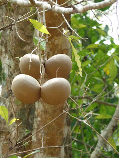
The ruins have very well preserved painting that are made out of lime and squashed bugs. Bright blue and red and yellow. very cool. Bonempak cost 42peseos but you have to pay 70 pesos to ride the last 9k even if you have your own transport.
Defenitely go to the very top and head back into the jungle on the right side. The steps just keep going up and it is so eiry- in a great way. The trees are growing out of the unearthed ruins. it just goes on and one and no one is there.

Also found the worlds greatest swimming hole with a rope swing over a water fall. Yes! We watch a few local boys play for a while and went after it once steve decided his 6'5" figure could take what the 4' tall boys were playing on. Deep fresh water gives me the creeps, so i had to get used to that for a while. So refreshing. So pretty. So many waterfalls.


metal pipe bridge

Tamaulipas


238 miles, 8 hours with 34 miles of dirt. Again the roads are paved and in great condition unless you take our detours onto the dirt roads. Lots of onion fields. The Mexican diet of meat is upon me as I struggle to find other options, all revolve around cheese so far. I knew this.
Tampico Alto is a little town with a plaza, if you get off the very loud highway. We stayed at El Corral Hotel. Local taco stands have been very cheap though. Gas is $2.50US per gallon. Fresh orange juice is plentiful! yipee.

April 8th Tampico Alto to El Tajin. 5.5 hours on the road through Alamo , or 4 hours on the toll roads. All times include our breaks, lunches, juice stops.....
We are not fans of highways and toll roads but i changed my mind on this trip. We took both routes to Poza Rica. I highly recommend the toll road around Tuxpan, it is so mcuh fast, less traffic and actually has better views. the other way is "the land of Topes" as Mexico is coming to be knows. Speed bumps everywhere! Slow moving and smokey from trucks. yuck. Take the $2.15 tol which no one want to pay so there is little traffic. El Norteno is a great restaurant in Tuxpan on the west side of the river bank on the city side, across from the floating expensive restaurant.

Poza Rica is one place I wanted avoid at all cost because I have such bad memories of the traffic from my travels in 1997. But we couldn't and it was the same but paved - which added a lot to the expreience this time. But still very hot, very stand still, very aggressive. Get out and head to the Cascada Auto Motel 3 miles before El Tajin ruins if that is where you are headed.

April 11th El Tajin to Monte Pio in Las Tuxlas. 265 miles. 10 hours
Big toll day. 94 peseos. Just trying to get south. The heat is getting intense. Highways are in good condition. heading to the beach! The road around the point of Las Tuxlas is beautiful, big cliffs into the ocean. We found a room at Claudias Restaurant out side of 2deAbril raod, in the family house which they evacuated, across from the beach. All to ourselves. Thank god for human nature, to cluster all in one place. They were all in town and we had our own quiet beach! We didnt have to worry about our stuff. As always people are friendly and helpful. We spent a day off at the beach eating mangoes and watching pelican do eye level flybys. Steve picked up about 50 sand dollars right out of the water while swimming. Easter Weekend is the biggest holiday. time to go to the beach for everyone. Good food in Monte Pio town.