Thursday, June 11, 2009

home, 6,538 miles later


First a little note about the aluminum box photos above. This is a little modification i did just before our trip. It provides a easy place to put everything when you are unloading the boxes. The cable hanges out to the side a little, but we never had it hang up on anything. I spent $12 on hinges, rivet and cable. the aluminum I got out of a fabrcators scrap pile. The Afrika boxes already have a space in the lid big enough on the side to fit the shelf when it is up.
Good luck and happy travels!


From San Miguel we headed north to Ciudad Victoria to spend the night in the hot town. Again, few places to eat and nowhere for breakfast at 7am. But the city is quiet enough and easy to navigate, so was a good place to stay. We enjoyed air conditioning here and also enjoyed one of the heaviest thunderstorms I have ever seen. It was a big push to get here but it was very do-able.
Just highways home. Fast traffic. Made it to Brownville by lunch.
We never got a receipt for paying the $22 each to enter Mexico and the immigration man wanted me to pay it again. He showed me the receipt from the bank. I have decided that anytime you pay a person and not a bank window, you are probably giving a bribe. The two guys in Reynosa probably pocketed our $44 dollars when we entered.
I would not pay this money again to the man in Matamoros and eventually won that argument that
“I never received a receipt. The sign here, right in front of me, says I must pay this amount when I enter. So how could I have possibly entered without paying it? I’m not paying it again, its too much money. I already paid it.”
The aduanas man checked out the bike and gave us a paper saying the permiso is canceled.. and they wont charge our credit card for taxes on the bike. Pretty painless all in all.
Crossed the toll bridge and waited in a long line to through US customs. After two months of going to the front of every traffic line, Steve tried it again and was met with unhappy people not allowing us to cut in. Finally a woman (probably a Mex resident) let us in. We got searched because we had some gifts and paid a dollar on our bottle of Mescal. The border guards seemed very shocked by our trip. I would have thought they see it more often.
Well we are back in the states. load the bike on to the truck and now, a long drive through Texas and New Mexico.
A great trip with friendly people and no problems. The bike did wonderfully and so did the driver.
6,538 miles all. two headlight fuses. 1 new tire. one bribe of $1.60 at the Guate border.
bike details to come

To San Miguel De Allende


June 1, 174 miles. $16 in tolls.
Mexico tolls are adding up but the roads are much better. The alternative is fulllll of speed bumps and stinky trucks.
This is a pretty, dererty dry ride with some nice hills. its a good highway through yucky concrete industrial world.
We stayed at a hotel on Calle Hidalgo with a quiet courtyard. 1 block south of the plaza. Mayorzongo or something. 350pesos. with the moto squeezed into the lobby. Hotels are expensive here so that was a good price for a big, quiet, clean room. (Next door to a nice gallery with ceramics.)
San Miguel is a beautiful town. We stayed two nights. The colors onthe buildings are bright yellows and reds and it is full of art galleries.

to texcoco around mexico city

may 31st. 174 miles with out orizaba
We headed out towards Mexico City with the hope of staying somewhere outside, in a smaller town. Without knowing how long things would take we kept on going. We stopped for a late lunch in Rio Frio due to cold, pouring rain. But there were no hotels so we continued.
We decided to head towards Texcoco when we got to the city. At the turn off the city traffic was really bad and there were lots of red lights in the distance, so we turned around and thought we could head through the city on the highway faster.
We couldn’t find the signs we were hoping for to get us north. I think the scale is just so big that we had to go much further along. We turned around thinking we could catch an over pass, but man, they just don’t let you back in. we drove miles back down the highway and took the biggest road north – After lots more traffic, rain, bad neighborhoods, more rain, we ended up back on the original road we didn’t want to take (136). So we took it. More rain, more puddles, more rivers and ponds. Sunday market was closing up , lots of traffic. Roads are flooded. A couple hotels look really seedy and what the hell, were soaked already. We keep going. Trucks splashing us. Laughing at our predicament.
Luckily we decided to go into Texcoco because there was not much beyond that for sleeping. (The road turn off says 142 instead of 143 as it says on our map). There are two hotels here, we got a big room with lots of space for clothes lines. I don't know if anything dried in the saturated air. Hotel Castillo and a good restaurant across the street. I'm cold to the bone.

To Tlachichula and Orizaba, Mexico’s highest peak (5,700meters)


May 30. 250 miles, $17 in toll roads!
$17 is steep, but it was completely worth it. At the turn off for the Toll road, we were the only "car" exiting from the overflow of Oaxaca traffic. We had the road to ourselves with a few buses. Unfortunately, it was not continuous divided highway, which is a nice break from oncoming traffic. It started out agricultural land and moved into mountains and great views. Dry desert and deep canyons.
There are two hotels in Ciudad Serdan. We continued on closer to the volcano to Tlachichula (9,000 feet), which has 3 hotels. The road is paved the whole way to town and beyond. We stayed at the mountaineers hotel, which seemed pricey at 120p each for a plain room, shared bath across the parking lot. But dinner was good and a good price and the family is nice. And they have cows to play with. Sunday is market day. And there is good bread here and internet. You can see the volcano from town. It was in clouds when we arrived in the rain, but cleared up later and wow, its great.

May 31, Volcan Orizaba
We grabbed breakfast in the market. Tinga for steve, shredded chicken in salsa in a big grilled taco. Big grilled bean & cheese taco yummers with killer salsa for me. There is a road that goes up to 14,000 feet, where there is a hut and a great view of the mountains. It takes about 1.5 hours to get up to the top of the road, and 1 hour to get down. 15 miles of dirt, Not steep, some ruts but mostly smooth pine forest and giant Lupine. We got to the base camp road at 9:20 and the clouds moved in at 9:45, fast. And covered it all. it was a great temp, dry and brisk. Not too windy. Wodnerful high altitude sun.
Reluctantly, we headed out towards mex city

To Oaxaca 12 years later


May 27th. It was a hilly, hot ride to Oaxaca going through lots of uninteresting roadside towns. The canyon road was great. Mountains, cactus, beautiful.
We stopped at a mescal factory. A small family operation, non irrigated, organic made by hand and horse. It was interesting to see the whole process and we bought .75lt bottle for 50p/3.50
We arrived starving after hours of nothing on the raod.
Oaxaca is big city with beautiful buildings, a great plaza and huge markets. I was there in 1997 and was in for a big change. Things are more homogenized, fewer small-scale handmade items in the market, and the gorgeous plaza is now unfortunately a tarp market selling generic household items and CD's. So it loses its feel. We still spent 3 nights here and visited some of the surrounding villages. We also had our box frame welded for a few bucks because we noticed in Huehue that two welds had failed. It seemed difficult to find food in Oaxaca that wasn’t really expensive. Our last night we found the northern part of the city that is more upscale with art galleries.
5,605 miles so far.

San Cris to Chiapa de Corzo for the Canyon Boat Ride


About 40 min, 38 peso toll road.
There is a National Park here called Sumadero canyon and you can take a speed boat down the canyon. It is really worth the 150pesos for the couple hours. It is something different to do, really pretty (overlook the ubiquitous plastic bottles) and relaxing (dido).
After searching through town, because the dock signs point you in the wrong direction for traffic, we finally got to the boats. We missed the boats and had to wait, missed the boat fill up again during lunch. After waiting again we went with a Mexican couple to the other boat dock out on the highway and paid a little more to “fill” the boat at 5pm.

The next morning we took off to Tuxtla Gutierez and took the national Park road look out over the canyon. Head towards Sumadero and keep your boat receipt or keep your bracelet from the road if you go there first. They give you a discount for both, about 22 pesos I think. We didn’t think to get a receipt.

Chiapa De Corzo to Tehuenatepec
229 miles. Long day, had to stop to fix the tire/muffler melting problem.
This road was hilly at the beginning but then straight, windy and hot. This town was just a good stopping point. Smaller than juchitan, sleepy in the morning. no breakfast except taco stands, but there is juice!

Border Day into Mexico

Huehue to San Cristobal de las Casas. May 22, 77 miles.
The road to the border was through a nice canyon. I have been nervous all night because of this crossing. We never got checked out of Mexico. We wanted to save the hassle of paper work being done twice for the permiso. So we just drove through at El Ceiblo and no one noticed. But with all of our passport stamp trouble and inability to pass through borders like this again… I was trying not to be nervous for the federal offense of not canceling your Mexico permiso.
It took two hours to get to the border and passed through the Guate side very quickly, canceled the stamp, paid nothing, done.
This border at La Mesilla is chaotic. It seems like Mexicans come over to shop so the road is Filled with stands selling all types of things, for miles. Small busy road. This worked to our advantage.
We had read that the Mexico immigration/aduanas is a few Km away. But it isn’t. maybe that is just the buses that are farther away.
There is an open gate type thing that we drove through with a nod of the head from the Guate(?) guy and then kept going.
We just kept going past the Mexican official whistling at us. I didnt really see him, but didnt expect to see him already. Steve thought he might be pig flu guy so we kept going. A random truck told us to go back, someone is waving at you. But we played dumb. Miles later, we got waved through the next military point and didn’t stop at the whistles at the next immigration point. We put the permiso sticker on the windshield this time and think it helped to not be stopped. I think i finally relaxed that night.
The road to San Cristobal de las Casas was a nice pine forest, hilly road.
San Cris is a great town. Not as grand in its buildings as Granada Nic, but better in some ways. There are a few plazas, great food of all kinds, inexpensive to eat, great coffee, pedestrian ways, museums and hipsters. We stayed three nights. I needed a break from moving and it was so nice to be back in Mexican food land. Even though for me it revolves around tortillas and cheese, the salsa and enchi sauce kicks ass!
We also ate Lebanese food, really enjoyed the restaurant El Mustacho behind the municpal plaza, went on a horse ride to San Juan Chamula’s market (where we didn’t feel welcome at all) and really enjoyed our visit to Na-Bolom museum. There is a big artisans market in San Cris.
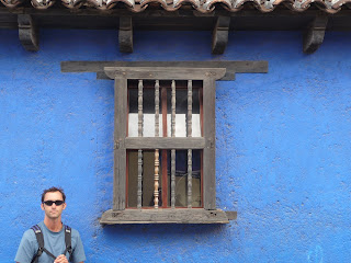
San Juan Chamula is a very traditional village a shot distance away, we went by horse. People are very guarded and are not friendly to travelers. Be very careful and respectful of taking photos. There is a big, colorful church in the plaza. that is really all there is to see. We went on market day and it was hopping.

Uspitan to Huehuetenango- best road in Guate


May 21
We headed out for Nebaj, a small traditional town, for their market day. it took 40 minutes from Uspitan and we spent about an hour there checking out the great clothing and jamb packed market. This town was very conservative and not very happy to see visitors. I have read that travelers have had trouble here in the past when taking pictures. Guatemalans are pretty superstitious of their spirit being taken and their children being taken. So you have to watch yourself.
The town was nothing special but the market was nice. People seemed especially short here and Steve was pretty much doubled over to walk under the tarp ceilings.
The rest of the day was just beautiful. The road and mountains were just beautiful. Valleys and rivers, landslides creeping in on the road, green. It was great!
Huehue is a big city. There was a bus driver assassinated the day before we arrived and there was a revolt on the police station (for inaction with the drug problem..?) which was set on fire. We saw the aftermath. Glad to see activism in action.

Landslide


Salama to Uspitan, 117 miles. over 8 hours.
I spoke with a man last night about the road conditions to Uspitan. He said there had ben a landslide and we couldn't pass there. It just happened a couple days ago. That was a problem, because we came all this way north to take this road and would have to back track a few hours otherwise. So the next morning we found some police to ask. They acknowledged that there had been a slide but that it was ok to pass now. So we went for it.
We exited through San Jeronimo. on the small dirt roads it took an hour to get to the highway(including being a little lost in the town). We thought of going to the Quetzal Preserve here but hadn't read any good reviews of it and we had a long day ahead.
it is a great high mountain, chilly damp road to San Cristobal. San Cris has a nice plaza and a nice small museum that we visited.
headed out towards Nebaj.
Not too far along, maybe 15 min out of town, we saw the landslide. The road stops abruptly with big signs and detours you to the left, so we continued. on this road you can see the slope, it ripped out from the ridge an flowed about 3500 feet down the valley almost a mile wide . We had never seen anything of this scale except one slide in India that was much bigger. but no one lived around there. this area in Guatemala was more populated and 40 people died in this slide which happened in january.
So that slide had been fixed, the cops were half right. a small road cut across the bottom of the debris, the way we were headed. It must feel strange walking on a skinny dirt track with a mammoth gapping wound looming above your head as you cross.

But the man who gave us the news was more correct. Four days before a new slide had taken out the path. There was no way for us to cross this due to a new river running through the road in a gulch.
Collectivo mini buses were lined up on the edge of the slide, waiting to fill up with people walking across. a long wait because there was very few people around.

We drove to the edge and spoke with a road crew for a while. January is the dry season and a slide like this happened. it made us think about this potential the whole day ahead. and the next few days activity was evident.
The roadcrew told us the best way to divert around the slide. We backtracked about 40minutes to another town called agua blanca.
the detour took 1.5 hours on rough dirt, rock, mud road. Super steep switch backs in places. nice views. we passed the bottom of the run out and saw the reservoir that was created in the river from the slide. huge.
we finally regained the road we started on and there was a lunch shack at the top for a very late lunch. Yippee. and a beer for Steve.
Steve overspiced his lunch and tried to feed some to a dog, which was very funny. The dog just couldn't stop licking its lips.
An hour or so later we got to Uspitan. We stayed at San Gabriel for 80Q. a really nice hotel with a shared bath for $10. Uspitan is a concrete town but with a nice traditional market in the morning out on the street and undercover. lots of little breakfast nook eateries with great wood stoves and tortillas cooking. cornmeal coffee and lots of getting stared at.
Guatemala has the best and most abundant traditional clothing, but the people are the most reserved and shy. sometimes we felt unwelcome, but they just werent used to seeing us.

Ipala Volcano to Salama


May 19th. 168 miles.
There is a crater lake on the top of Ipala Volcano which we went to visit for the morning. it is beautiful and has a nice small hike with lots of epiphites. It took about 30 min on paved roads to Agua Blanca and then 20 min on dirt to the top. We used the Parada Village access. It was a small road, in good condition but pretty steep in spots. There were nice views of the surrounding country side and the other volcanoes in the area. There is a crucial left fork that you take onto a smaller road and then keep right at the next and left again up hill.
There is a parking lot at the top that charges 10 quetz so you can leave all of your stuff safely. We were the only ones around other than the nice family running the lot. It is a one minute walk up to the visitors center. you can camp on the lake shore for a few dollars or stay in a tiny door room for a bit more, and its 10Q per person to enter the park.
We drove to Salama via Jalipa, a pretty drive that took about 4 hours. There was not much to see in Salama but there was a nice plaza. We stayed at Don Marco for 80Q/$10. Guatemala has inexpensive rooms and more expensive but better food.

About the picture of the guy with the shotgun at the gas station. This is a common site throughout our entire trip. Armed guards at nearly every gas station, department store, banks, book stores, you name it. Any place that might have lots of cash it seamed. It's one of those things that you kind of get used to.